The Promised Land Overview
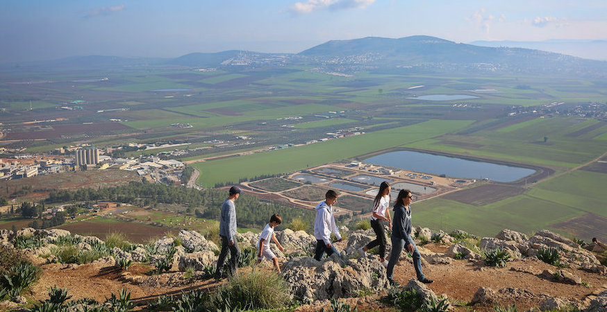 View from Mount of Precipitation, Northern Israel. December 22, 2018 | Photo: Yaakov Lederman/FLASH90
We began this series, Walk through the Land, by looking at different regions, starting with the Sea of Galilee.
However, an overview of the entire land, though belated, would be appropriate, so we offer it in this edition. The regional approach will continue in the next edition.
A Good but Thirsty Land
“For the Lord your God is bringing you into a good land, a land with brooks, streams, and deep springs gushing out into the valleys and hills; a land with wheat, and barley, vines and fig trees, pomegranates, olive oil and honey; a land where bread will not be scarce and you will lack nothing; a land where the rocks are iron, and you can dig copper out of the hills. When you have eaten and are satisfied, praise the Lord your God for the good land he has given you.” Deuteronomy 8:7-10
Yes, the Land of Promise is a good land. The land is also a small one – 420km by 110km, topographically diverse, and strategically located. Its waters are modest – in brooks and underground sources – not mighty rivers. Yet it is a fertile land with a variety of wonderful foods – grains, fruit, olive oil and honey – if only you can bring water to the crops. The ancients were dependent on rain, while modern Israel also uses the National Water Carrier.
“The land of promise is unlike any other. It literally sits at the crossroads as a land bridge between Africa and Eurasia”
Crossroads
The land of promise is unlike any other. It literally sits at the crossroads as a land bridge between Africa and Eurasia. You literally cannot go from one landmass to the other without crossing through this tiny land. Other crossroads include:
- Geography: The Mediterranean is pitted against the largest mass of desert imaginable, including Arabia and Sahara.
- Weather patterns: Cool air comes from the Atlantic in the West and Russo-Siberia in the East.
Song of Songs 4:16: “Awake, O north wind; and come, you O south wind; blow upon my garden, let its spices flow out. Let my beloved come into his garden, and eat his pleasant fruits.”
While the north wind is moist and life-giving, the wind from the desert is not. It is hot, dry, and extracts all moisture. We know it as the east wind, which blows around 50 days out of the year. In Arabic, it is called Khamsin (50) and sharav in Hebrew. The east wind deposits fine dust on everything, denudes the trees of vegetation, dries out the air, and causes mild-mannered people to become irritated. Jonah 4:8: God allowed hot sun and east wind to buffet Jonah, and he wished to die!
- Highway: The name of the highway from Egypt to Mesopotamia is unknown in antiquity, though Isaiah 9:1 refers to it as ‘the way of the sea’ or Via Maris. We call it the Afro-Eurasian highway. Its length is 2,850km from Thebes in Egypt to Ur in southern Iraq. In the Old Testament, it was unpaved, worn down by travel, no weeds, with either donkeys or camels pounding their hoofs on the hardened pathway. Camels were particularly robust, handling 180 kg of goods.
- The Roman Road: There was a marked improvement in the roads during the Roman times: paving stones, prepared roadbeds, ground levelling, and drainage made travel across the land and the empire much easier.
- The route of the Afro-Eurasian Highway: From Egypt and Northern Sinai, the highway went about 15 km inland of the Mediterranean as it went northward along Israel’s coastal plain, cut through a natural gap in Mount Carmel, entered the Armageddon Valley at Megiddo, then on to Galilee, Golan, and Mesopotamia. Since Israel’s independence in 1948, the highway has been closed, though Isaiah 19:23-25 predicts its glorious reopening from Egypt to Assyria (northern Iraq) via Israel.
Diverse Topography
Despite the diminutive size of this land west of the Jordan River, it has amazingly multi-faceted topography. You name it – it has it. Moonlike wilderness in the south and alpine high snow-topped mountains in the north (with a ski resort). Below sea level is the Rift Valley sector which also is varied, including a freshwater lake and a saltwater lake in the same country, the same valley, and fed by the same river. The coastal plain is relatively straight, and solid limestone mountains are in the centre. On the eastern side of the watershed is dry desert; on the western side, it is green and forested, thanks to the cool, moist Mediterranean air and an energetic tree-planting programme.
Regions
We will travel from north to south, east to west. If you have access to a holy land map (the back of your Bible will do), join me on this quick overview.
East of the Rift Valley
Going north to south, we have the Golan Heights (Bashan), held by Israel, the Yarmouk River separating Golan from Gilead (in Jordan), then Jordanian Ammon, Moab, and finally Edom in the south, where Petra is located. It ends at Aqaba on the Red Sea.
Rift Valley
The Rift Valley is around 6,000 km and goes north to south from Turkey, to the Red Sea, and into Africa, housing some of the great lakes, and ends in Mozambique in Southeast Africa. The valley is the spine and eastern border of the holy land.
The holy land portion of the Rift Valley starts in the north with the Huleh basin, then Sea of Galilee, the Jordan (River) Valley, Dead Sea, and finally the Arabah which leads to the Red Sea at Eilat.
“The Central Hill Country, known as Samaria and Judea (the world calls it the ‘West Bank’)”
North
Galilee (upper and lower) is in the far north, then the Valley of Armageddon (Central Valley), then the Central Hill Country, known as Samaria and Judea (the world calls it the ‘West Bank’), followed by the Negev.
Bonus Regions
Mount Carmel in the north and the Shephelah (lowland) in the south.
Coastal Plain
Plain of Acre (Asher), south to Plain of Sharon, then Plain of Philistia.
From this tiny postage stamp of real estate has come the stage of God’s revelation and humankind’s redemption.
To be continued.

Why Israel? by Rev. Willem Glashouwer
Order the book